Archive for the ‘Recreational Riding’ Category

March 27th is not the earliest date for my first ride of the year but this 2016 debut was probably the most enjoyable early season ride I’ve ever had.
With sunshine and a temperature of 12C I was able to wear cycling shorts and was very comfortable.
Before I could hit the road I had to do a little prep. Fortunately, the mountain bike was in pretty good shape – the one thing attention needed was the chain. I was out of my usual dry wax based lube but found some of this:

It worked fine and I was soon able to head out on the road (without squeaks).
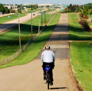
My ride took me from downtown via bike paths and Ada Boulevard to Rundle Park and then on to Hermitage Park. There was only one section of the bike path still covered with snow and ice but fortunately it was only about 30m and I was able to detour via the adjacent grassy field. The road and bike paths were as dry as I’ve ever seen them at the end of March in Edmonton. The sand/gravel was also not bad at all.
Here’s a bit of what I saw along the way:


From Rundle Park on the way back I crossed the bridge to Goldbar Park and followed the southside paths to the 50th Street Bridge where I crossed back to the north side.

Back on the north side I got off pavement and on to dirt trails.

These dirt were very dry (and actually a bit too hard for the tire pressure I had).

It was a great ride. I covered 25K which is more than I probably should have done for the first ride in over four months. My legs handled the easy pace but I was feeling it in the back of my neck from the now-unfamiliar hunched over riding position.
Today may be the day to break my winter cycling hibernation. I was out for a run yesterday and had a chance to assess some of the paved and dirt trails. There are enough good ones to give it a go and with a high of 12C forecast for this afternoon the only thing standing in my way is getting the bike ready. This is what has held me off so far more than the road/trail conditions. I will need to clean and lube my chain which even with the ease of modern products tend to put me into procrastination mode.
Here is how trails through Dawson Park looked yesterday:


Caution required on deteriorated path
And on the dirt trails east of Dawson Park to Capilano Bridge and on towards the 50th Street Bridge it looked like this:

Beside the trail, looking east towards Capilano Bridge

Dry gravel path

Looking across the river

While the sun-exposed north bank of the river valley is nicely dried, shaded areas such as Kinnaird Ravine, up from the east end of Dawson Park are ugly. I had trouble walking here a day earlier and wouldn’t chance it on two wheels.

Kinnaird Ravine's icy/slushy trail
Enjoy your ride – maybe I’ll see you on the trails and road.

Here it is November 22nd and I managed to sneak in another ride. Although we had a bit of snow one night this week it had mostly disappeared by this weekend. This Sunday afternoon the sun was out, the temperature around 4C and the paths were dry and clean. No problem for cycling through the river valley but with the North Saskatchewan River clogging up with ice, it would have been a poor day for kayaking (not that I do – not that I wouldn’t like to – but not at this time of year in any case! I digress.)

The Icy North Saskatchewan River in central Edmonton
The only problem with riding at this time of year is that by mid-afternoon when it is warmest, the sun is already on its way down in the southwest sky making it difficult to see.

3:15 pm in Edmonton’s Rundle Park
There were not a lot of cyclists out on this November afternoon, but I did see a few.

Dawson Park
While the paths were for the most part very dry and clean one does need to keep there eyes open for the occasional ice patch.

Icy spot in Dawson Park

Contrasting the icy river with the nice clean bike path.
I post these images mainly for the benefit of anyone who is not familiar with Edmonton and thinking that surely no one could be cycling that far north in November. Sure this is turning out to be an exceptional month but it shows that cycling is possible and the river valley beautiful enough to make the effort worthwhile.

Me – to prove I really was out there on Nov 22nd 2015.
2015 has been another poor year for cycling for me but any November day that I can get out on the bike in Edmonton is a win. Today, November 14, was one of those days. Most years in Edmonton there will be snow on the ground by mid-November and although year-round cycling is becoming increasingly common in this city, it is usually reserved for riders with fat bikes and studded tires. However, “so far so good” this year – the paths were dry so I on my slicks needed only to dress appropriately for the 4C temperature and the experience was enjoyable.
This is what the Edmonton river valley looked like:

Canada Geese sitting on the frozen surface of a pond in Rundle Park

An unusual bit of green leaves on some trees at the east end of Rundle Park
It was nice to see a handful of other cyclists out enjoying the afternoon:

The bare trees of a more typical mid-Autumn landscape in this part of the world

The climb out of the valley at the west end of Rundle Park

The descending path into Dawson Park

The undulating path through Dawson Park

My riding perspective
I may be pushing my luck in hoping that this wasn’t my last ride of the year but that’s what I’m hoping for.
2013 May 26 – another Sunday morning, another Target the Tour training ride with the Edmonton Bicycle and Touring Club, starting from a service station on the south side of the Yellowhead Highway, a little west of Ardrossan.

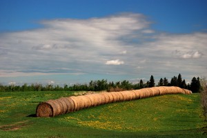
This day’s route took us North of the highway for a while before returning to the more familiar roads south of Ardrossan. It was a pleasant day and nice to see the countryside greening up. Here are some photos from that day, without further commentary:


Here in Edmonton winter lasted as long as I ever remember. There was snow on the roads into April and although eager to get back on the bike it seemed as if we were defeated before ever beginning. There was not a long training period before the late-July Tour de l’Alberta which had been my usual early season goal.
Nonetheless I started the season joining other EBTC members for the Target the Tour training rides starting out at Ardrossan every Sunday morning. May 19th was only my second Sunday ride and although I didn’t have a lot of training accumulated I was eager to make up for lost time. If I felt okay I would do the longer (up to 80K?) option
 As is typical on these group rides I see a lot of the group early on and virtually no one the last couple of hours. However, the rural and farm scenery is always there to keep me company.
 Reaching the half way, lunch spot at South Cooking Lake I felt good enough to tackle the long route (although something told me It might not be a good idea). I had one riding partner keen on doing the same things so we set off south along a nicely paved secondary road. At a certain point we would take a smaller road west for a few kilometers to join up with another road taking us North.
 When we reached the designated turn-off we looked – hard – twice! This road wasn’t paved at all – just gravel, and loose stuff at that. However considering it was just a couple of Ks it seemed like a better idea to continue than to backtrack. Well, a couple of kilometers of loose, rough and slippery gravel and we realized that there would be a lot more where that came from. At this point we admitted defeat and went back along the gravel road then back up the highway until we could find a paved east-west road.
Oh did I mention the mosquitoes?! They were horrendous along this stretch of gravel – especially bad when we stopped to consult the maps and assess our situation but even when we were on the bikes we weren’t moving fast enough to outrun a swarm of mosquitoes.


The rest of the ride back was uneventful but it was a bit of a grind at times with a headwind. Then, unfortunately with about 5K to go, I bonked! I completely ran out of fuel reserves and was reduced to crawling (figuratively) back to my car. It was a good day, a good workout but in retrospect, perhaps a little more than I had trained for.
Ah … back on an EBTC Target the Tour training ride.

Pre-ride Instructions
For one reason or another I had missed the previous few Sunday morning rides. Although the weather forecast had looked a little iffy, with possible early morning and late afternoon showers, It was absolutely beautiful as we gathered at 0930 for a planned 100k ride in the countryside northeast of Edmonton, out to the town of Bruderheim. [map of region]
Although this ride would be my longest one of the year and I hadn’t been on the bike much in the last couple of weeks I was feeling good and confident. A group of 25 riders, set off this morning on a route that would take us north from the Yellowhead highway, through Fort Saskatchewan and then north east to the town of Bruderheim before returning on a slightly different route.

Crop Rows (a bit unusual as most crops in these parts are fields of canola or grains)

Canola Field and Rural Road

Straight and Flat
It was beautiful, uneventful morning – well except for my getting-all-to-common electronics challenges. First, my cycle computer which I had again thought I had fixed wasn’t picking up the signal from the front wheel so I has no speedometer or odometer. All i could use it for was as a timer. It told me how long I’d been on the road but as I had inadvertently stopped the timer at some point and lost approximately 7 minutes. I have no options now for this device other than to try to replace the thin wires (soldering will be difficult), or to get a new unit.
Luckily I had my Garmin heart rate monitor with GPS as a back-up – except that 1 Km out it displayed a message that it could not receive signals from the satellites – this out in the middle of the flat prairie! After approximately 10K the function mysteriously returned but for the rest of the ride I didn’t now how far I’d gone or had to go. I was able to get my speed although looking at the watch and changing screens while riding was not very convenient.
The other technology challenge encountered was that after I’d taken only 5 pictures, my camera indicated that the memory card was full. This was not a big problem but did mean that I had to take the time to manually delete a bunch of my oldest photos from memory to free up space.

Petro-chemical Plant
The ride north to Fort Saskatchewan was on the quiet rural roads. From there we took Highway 15, a busy 4-lane divided highway, but with very wide paved shoulders – not a bad stretch at all. This section of rural Alberta is noted for petro-chemical processing. Large industrial plants are frequently next to farmer’s green fields as a well as small pumping units in the fields.
During this part of the ride to the northeast I could notice the effect of the wind blowing from the southeast. The result was that my pace fell off noticeably, probably to something like 15kph. However, once we turned back north, I was flying – cruising along at more than 30.

Rural Road (to get back on course)

Gravel Road (to get back on course)
After another eastbound stretch on a rural road into the wind, I came to the intersection with a highway. By this time out group of riders was pretty stretched out and I was riding on my own with no one else in sight. So I quickly pulled out a map in my back pocket and noted that I needed to go north on this highway (830) so I turned left, and with the wind at my back I was again flying.
It turns out that I shouldn’t have turned! I had looked at the preliminary map that I also had in my pocket but we had already gone as as far north as we were going. I noticed my error when I stopped to check at the next intersection, a couple of kilometers down the road. I could have (probably should have) simply backtracked but decided that I would take the eastbound road at that intersection and then take the next south road to get back on course. Most of the roads in these parts are along a rectangular grid – very predictable!
The rural road which I took east was a bit rougher in places than the ones I had been riding on but not bad. when I came to the next crossroad I headed south. This road however was much rougher, a gravel/dirt road. I was glad I was riding my touring bike with its bit heavier/wider tires rather than ones only suited to paved roads. The road surface wasn’t as bad as the headwind I now encountered. My speed dropped to something like 13 Kph which made it seem like forever to cover this 3 Km stretch. It did however only take 15 minutes to get back and then shortly thereafter arrive in our designated rest stop in the town of Bruderheim [map].

Rest in Bruderheim
It was good to see others of our group there, but they had already been there for awhile and by the time I had a blueberry muffin and some Powerade, they already had a 10 or 15 minute headstart on the ride back.
When I did get back on the road it was due south, into the wind, for 3 kilometers. Although I had only stopped for 15 minutes it felt as if my body was starting to seize-up. Back on the road, I was noticing an uncomfortableness in my left knee. Since this knee had been an occasional problem in the past I was a little concerned.
After the 3K I turned right onto the major highway and was traveling in a westerly direction. Even though the wind was not fully at my back, enough of it was that I felt I was flying again. Indeed my speed had gone from the 10-15 Kph range to averaging in the 30’s. After a few kilometers it was a turn south and a long straight stretch in to that wind.
(Was it jut the fatigue of having already ridden 60 or 70K or was the wind really picking up as we headed into mid-afternoon? Anyway, it was a drag, a slow, head-down, solo ride that quite frankly wasn’t much fun. I did stop for a few photo breaks but not as many as I would have liked.

Prairie Field and Summer Sky

Prairie Rails
Eventually I did catch-up with Chas in his support truck and then with a couple of other riders. I stuck with them until we got to the end of the ride. We were looking forward to a break from the long headwind stretch.

The Long Road into the Headwind
We were supposed to turn west onto a quiet road for a few kilometers but when we got there we saw that the road had been very recently oiled, so we continued south to the Yellowhead and then rode that busy highway back to the Ardrossan turn-off.
It was around 3 PM when we got back – a little over 5 hours on the road. It had been a decent ride, especially nice on the first half. I had looked at this ride as a test of my fitness in evaluating if I’d be up to doing the 180K Tour de l’Alberta distance in four weeks. Having completed this ride, the thought of heading right back out and doing practically the same distance again, pretty much answered my question – I’ll be sticking to the 100K distance on July 22nd.
The evening of the 2012 summer solstice – a beautiful evening here in Edmonton and it was time for me to get back in the saddle – literally and figuratively.
Back in the saddle figuratively because I had not been out on the bike for nearly a couple of weeks. As sometimes happens, life throws you a curveball and mine meant that I had to cancel on my much-looked-forward-to Silver Triangle tour. That disappointment meant I didn’t feel much like riding for awhile. But like they say when you fall off a horse, you’ve just got to pick yourself up and get back in the saddle.
I was back in the saddle literally as I took out the oldest bike in my stable, which is equipped with a classic Brooks leather saddle. This old bike is my first “real” bike, an Apollo MKIV. I will have to dedicate a future post to it, but for now I will say it is my road bike, the one I use for just going fast (which is all relative of course). The Apollo was my all purpose bike back in the day, used for recreational riding and touring. It was equipped with fenders and a rack and was what I rode on my first tour in France. Today it is stripped down to the essentials, with narrow high pressure clincher tires. The biggest change to the bike is the pedals I put on a few years ago. I replaced the traditional metal platform pedals with the small ones that cleats clip into. I love the way these pedals make me one with the bike (and occasionally “too-one” when I have not unclipped before stopping.). The seat however is still that comfortable old leather saddle – they can take a long time to break-in but once you have …
This evening ride was great – the sun was shining brightly and the temperature around 20C. I rode a relatively flat route through the Edmonton river valley and covered 28K. One other “feature” of this road bike that differentiates it from my touring bike is the gearing, which has a very narrow range. My lowest gear is something like a 48-24, so on the couple of times that I had to climb out of the river valley it was not a leisurely sit-back-in-the-saddle climb. It was a standing-up, rocking from side to side type of climb – but I felt powerful and I liked it!
Now that my big tour plan is behind me it is time to focus on my next goal, which is the one-day Tour de l’Alberta ride at the end of July. I am now thinking that I will probably ride it in the saddle of the old Apollo.
With a couple of days of rain this week and a couple of days of fatigue, here it was Friday already and I hadn’t been out on the bike since Sunday’s Target the Tour group training ride. That one ride will not be enough by itself to get me into shape for touring the Silver Triangle in June. My plan has been to get in two progressively longer rides each week in addition to moderate daily rides. So today would have to be a longer ride. The weather looked fine so I decided to try a new route of what I estimated to be about a 75K distance – from central Edmonton to Fort Saskatchewan (a small city northeast of Edmonton).

Meridian Street
As soon as I had finished watching the day’s coverage of the Giro d’Italia. I got ready and headed out to the bike. At this point I discovered a small technical issue (actually two of them). Normally I wear my Garmin HRM/GPS and have my Cateye cycle computer (odometer, speedometer etc.) on the bike. For some reason the Garmin would not turn on and a probelm with a loose wire on the Cateye meant it was only intermittently getting a signal from the wheel sensor. The net result was I had not indications of speed or distance. On the way home I turned on the GPS on my iPhone which indicated a distance of about 36+ kilometers, so counting a couple of extra Ks in Ft. Sask my total was likely close to the estimated 75K.
My route to through Edmonton to the northeast was my usual (Dawson Park, Ada Boulevard, Rundle Park, Hermitage Park) along the bike paths and routes. From the top of the valley at the North end of Hermitage Park I dipsy-doodled my way north through the residential subdivisions until I reached the countryside at 153rd Avenue [map]. A couple of kilometers east I hit Meridian Street, a lightly-traveled rural road, and headed north. this road passes through farmland and, a few small acreage subdivisions. The road is in pretty good condition and the ride is pleasant!

A Sikh Temple in the distance across a fallow field
Approximately 8K north, Meridian Street is intersected by the Fort Road, which I turned right and followed. However, looking northwest from that point, across the fields and behind some trees one can see the unexpected sire of an ornate Sikh temple.

Turn onto Fort Road

Old Fort Road – an Idyllic (if rough) Country Road
The Fort Road is busier, as would be expected from the center and shoulder line markings, but it wasn’t too bad, late morning when I was there. I followed this road northeast for 4 or 5 kilometers until it intersects Manning Drive (Highway 15). At this intersection it is necessary to turn right and travel on the highway. It is not a bad stretch of road, it starts off divided with a wide shoulder (then becomes undivided but still with a generous shoulder.
.
The highway stretch is just for a couple of kilometers before I turned right onto the Old Fort Road (Township Road 545). This is another quiet road through the farmland – very peaceful. Well peaceful but with a very rough road surface. It was paved and not particularly broken up but it was kind of jarring. The fact that I had a very-unusual-for-me headache today meant that I really noticed the roughness.
.

The Highway Bridge to Ft. Saskatchewan
The Old Fort Road takes us to just below the highway bridge that crosses the North Saskatchewan River and leads into the City of Fort Saskatchewan. To get onto the highway it is necessary to first turn north onto a little road before turning right onto the highway.
This bridge crossing was my least favorite part of the ride – the traffic was moderately heavy (with big trucks), the shoulder was narrow compared to the open highway and the shoulder was also a bit rough and dirty. Full focus is required is required for a few hundred meters and I appreciated my rear view mirror
Once across the bridge the shoulder widens and taking the exit to the right, one is in the City. After first going west, I found downtown was to the east and offered more food options. I found a place to grab some lunch and took a break for half an hour or so then headed back, along basically the same route.
Again the bridge crossing was the only real concern but once across, I turned right and went back south, under the bridge and along the old Fort Road. Shortly back on to this road I came to a railway crossing where care was called for (as indeed it was when I crossed on the way out). The timbers are old and rough and the rails are at quite an angle to the road but again traffic was light so there was no problem in taking it very slow.

Old Railway Crossing on the Old Fort Road
My return route deviated from the outgoing one only slightly as I was coming back into the Northeast Edmonton residential area. There was construction on the little dirt road I had taken to get to 153 Avenue so I couldn’t turn off 153rd at the same point.

A Gravel “Connector” Path
I continued west to 18th St., then went south on a little gravel walkway (after having to carry my bike over a barrier). This gravel path was only about 300 meters before I got back on the residential road. It wasn’t a bad ride on my touring bike (with a bit wider tires) and would have been no problem on a mountain bike. I retraced my route back to where I could connect with the bike path at the end of Hermitage Park. From there it was just 15K or about 45 minutes) to home. Well “just” that with a couple of significant climbs, the only real ones since about 50K back. Overall this was a very flat route.
.
I did like this route and look forward to riding it again.

Quiet Countryside on the Road to Fort Saskatchewan
Yesterday (May 7th, 2012) was another first (for this year anyway). It’s what I like to call “green day” – the day on which the Edmonton river valley suddenly turns very green as the trees burst out in leaf and the day when my spirit takes a noticeable jump!

The Greening of the Trees (Rundle Park)
I was out on the bike and I had a good ride – my longest of the season, covering a distance of 60K in just over 3 hours, (without a major rest break). The sun was shining so I broke out the sunscreen for the first time this year. The temperature was up to 20 so I was quite comfortable in shorts and a light short sleeve jersey (that’s the way I like to ride). Also at that temperature and distance I paid attention to my hydration. I’m not sure if I did drink enough but I did make a point of having a swallow or two of water every 5 kilometers.
To get the 60K distance along the Edmonton river valley bike trails, I basically (although not exactly) combined my 20K east loop with my 40K west out-and-back route. I started out east, through Dawson Park, along Ada Boulevard on the top of the north river bank to Rundle Park [map]. After a loop around Rundle, I crossed over to Gold Bar on the south side of the river.

The North Saskatchewan River (high and ice-free) – looking west from near Rundle/Gold Bar parks
It was my first time this year on much of the south side trails [map] since they tend to be shaded and the snow and still be on the trails long after the exposed north side trails are clear and dry. There was however absolutely no snow or even wet paths, yesterday.

Bike Path looking west towards Riverside Hill
To be honest the other reason that I have not ridden the south side trails, is to avoid one particular hill – the killer slope on the east side of the Riverside Golf Course. The fears were unfounded though, I geared down and grinded my way up with little trouble.

A good section of the downhill path
Coming back down from the top of the bank at the south end of Forest Heights Park I became aware of how a number of sections of our prized cycling path network is in poor shape. This downhill section in particular, reminded me that extra caution is required as the condition of the paved surface is no longer a match for the speed which one can easily reach.
II continued to follow the bike paths on the south side of the river, beside the Cloverdale community, under the Low Level and James MacDonald bridges, through Queen Elizabeth Park and on to Kinsmen Park. At the west end of Kinsmen, the path turns south, up the river bank (which turned out to be more of a climb than I remembered). The path at the top of the bank follows Saskatchewan Drive along the north edge of the University of Alberta main campus. Then it was down Emily Murphy Park Road, over towards the Hawrelak Park entrance and right back up again on the sidewalk beside Groat Road. The next kilometer or so, of path is flat following the top of the bank to the old Keillor Road. A nice downhill section here with a few switchbacks leads to a nice path that is straight and in great shape – wonderful for riding out the downhill onto the long flat stretch beside the Whitemud Equine Centre.

Where the Whitemud meets the North Saskatchewan
Shortly thereafter a small bridge crosses the Whitemud Creek ear to where it empties into the North Saskatchewan River. I am often seduced into a brief stop on the bridge and perhaps a picture (or two) before carrying on, under the Quesnel Bridge, then along the east/south side of the parking lot at the John Janzen Nature Centre and Fort Edmonton Park [map]. The bike path then skirts along the south end of Fort Edmonton Park with some gentle hills and some glimpses into the historic park. I quite like the trees along this section of the route and therefore often stop to take photos here too.
The nice, paved trail ends suddenly at a corner of Whitemud Road. To go right takes one down to a pedestrian cycle bridge across the river but here I go left [map]. This section of road is definitely the worst of my entire route. It is steep so be sure to gear down before you start the climb. The road is also in very poor condition with broken pavement and a lot of sand and gravel (especially scary coming back down). Near the top of the road (where it technically is called 58th Avenue) I turn right along a walkway between some houses that puts me back on Whitemud Road. The next part of my route (in fact until I turn around and retrace by path) is on relatively quiet residential roads. I continue south on Whitemud Road turning right (west) when the road itself becomes 43 Avenue [map].
This section of Whitemud Road becomes Ramsay Crescent which offers a great view west over the river and beyond. This view is offered from the place where 2 or three homes slid down the river bank a number of years ago. Where Ramsay Crescent bends away from the river, I veer right and take a path that continues along the top of the river bank [map]. This path is paved for a ways and then it becomes shale and dirt. I take it for a few hundred meters, until I can get back onto a residential street, Romaniuk Road. This street turns into Rooney Crescent which I follow until turning right onto Roy Street, then right again onto Roy Gate.
Roy Gate takes me to Rabbit Hill Road, which I cross, then follow along Heffernan Drive [map] until it intersect Heath Road, where I turn right. I continue south on Heath Road for a few blocks, past where it passes through a utility corridor (with bike paths east and west). I turn right onto Hector Road and follow it until I reach my turnaround point (a point which gives me a 20K ride home). As I usually do, I pause at this point, munch on an energy bar and have a few swigs of water before heading back north and east.
I didn’t retrace my steps exactly this day (or it would have given me an 80K ride rather than the goal 60K). However I did go back on the same route just described all of the way to Hawrelak Park. The nice thing about my return route is that there is only one significant climb – at the east end Keillor Road (back up to Saskatchewan Drive [map]. This was the one that I so enjoyed the ride on the way down, now it’s payback time! It’s not actually that bad. Having ridden it often enough I know the pace that I need to maintain and I can even usually make it up comfortably without using my lowest gear.

The start of the Keillor Road climb
From the top of this climb, it is back along Saskatchewan Drive, down Groat Road (again the “sidewalk” on the west side of the road). Here is where my return route differs from the outgoing one. I follow the road north out of Hawrelak Park, over Groat Road and then cross the Groat Bridge on the east side sidewalk. At the north end of the bridge I take a quick right on the path and connect with the cycle path along the south side of River Valley Road [map]. This long, straight, flat path takes me east to the traffic lights at 105 St. I then follow the path beside the river as it skirts around the Rossdale community, then on past the convention centre, through Louise McKinney Park and past the Cloverdale footbridge and finally into the Riverdale community (where I finish my ride) [map].
It was a good ride, a long one I had to make up for missing the Target the Tour training ride the day before. As good as I felt during the ride, I was certainly wiped out later. I have a ways to go with my training in order to do be able to ride 3 consecutive 100K days or to be able to cover 180K in a single day – but so far so good, no injuries and incremental progress.
With the local trees leafing-out, the world turning green it really feels like the cycling season has begun in earnest. See you on the trails!


